Adirondack Hiker

Sunday, May 14, 2006

The Great Range (Part 6) - The Failed Crossing

Arriving back to camp shortly after 6:00 p.m., we quickly packed up and prepared to head back to the car. In hopes of preventing a repeat of the initial difficult crossing of John's Brook, we took a look at the map and prepared a new route out. Rather than crossing the brook near the John's Brook Lodge, we would continue on the trail further downstream to a crossing quite near to the Garden Parking Lot (where our cars were parked). Based on our conversation with two other hikers who were resting at our lean-to when we arrived back, it was thought that there was a bridge at this point.

It was around 7:00 p.m. when we packed up and headed out. If all went according to plan, we could make it back to the car shortly after 9:00 p.m. We would be tired for the 2.5 hour drive back home, but it didn't seem to unreasonable.

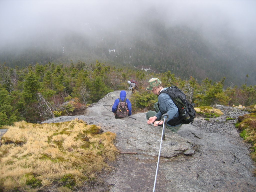
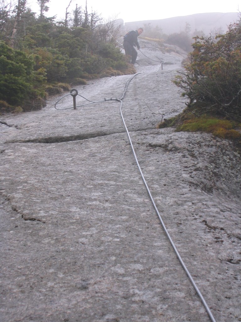
Once again carrying fully loaded packs, we set out. We made good time on this fairly level trail running adjacent to John's Brook. After the first few miles, the trail widened into what seemed to be a four-wheeler trail. However, the trail forked (which of course wasn't on the map) and we decided to take the path closer to the brook. After 15 minutes on this path we were brought to a stop by a series of falls in the brook. We had taken the wrong turn. We doubled back and headed for the other path at the fork -- a slight delay, but we still weren't far off schedule.

It was dark around 9:00 p.m. when we finally found the crossing, clearly marked with a sign directing us to the Garden Parking Lot. There was just one problem: there was no bridge. Deep, fast-moving white water was all we had ahead of us. This crossing looked far worse than the one we had crossed initially, nearby to the lodge. The parking lot was close now, less than a quarter mile away, so we set out looking for a place to cross. If we could find anywhere suitable, the consensus was to "bomb it." We didn't care about getting wet now -- we'd plow right through that brook whatever it took.

We searched. A half-hour later we still hadn't found anywhere remotely safe to cross. With this white water, you didn't want to go down with a fully loaded pack -- you may not be able to get back up. Hopping out partway along some big rocks, Adam tested a possible crossing. Slowly lowered his legs into the water while holding himself steady on the rock, his feet never hit bottom. This was deeper than we expected -- still too dangerous to cross.

Frustrated, we began to consider our options. We could still attempt to "bomb it." Without packs this might be doable. With packs, it was stupid and dangerous. That wouldn't work. We could head all the way back to the John's Brook crossing. That would be over 4 miles. It was late, and it was dark. That wasn't much better of an idea. We could just set up camp here and wait until morning. We were so close now that we decided against this idea too (Adam was still in favor of camping as he had been before, and in hindsight this would have been the best choice). Lastly, we could continue on the trail downstream. After a few miles, this would lead us into Keene Valley and to an actual road. We could cross a bridge here. We chose this option.

We trudged on, frustrated at our defeat by John's Brook. After what seemed like an eternity, we hit a dirt road. Eventually, a few lone buildings came into sight as the road turned to pavement. Several forks and turns later, we were guessing our way in the general direction of Keene Valley. Several more forks and turns later, we came to a bridge. We had no idea where we were. Adam, not exactly happy that we hadn't listened to him and stayed at camp hours ago, pointed out our errors of not paying close attention to the compass and the map.

We got out the map and tried to figure out where we were. We could either cross the bridge or continue on north on this road. Just as we had decided to continue north in hopes of reaching Keene Valley, Ed made a discovery. We were at the road leading up to the Garden Parking Lot. I confirmed his theory when I noticed a large boulder at the side of the road that I remembered driving by on the way up. Finally, events were turning in our favor.

We headed across the bridge and up the hill to the parking lot. A long, painful mile and we had finally made it back -- after 11:00 p.m. It was going to be a long drive back.

Adam reminded us that this wasn't his idea with a well-earned, "I told you so."

---------------------------------------


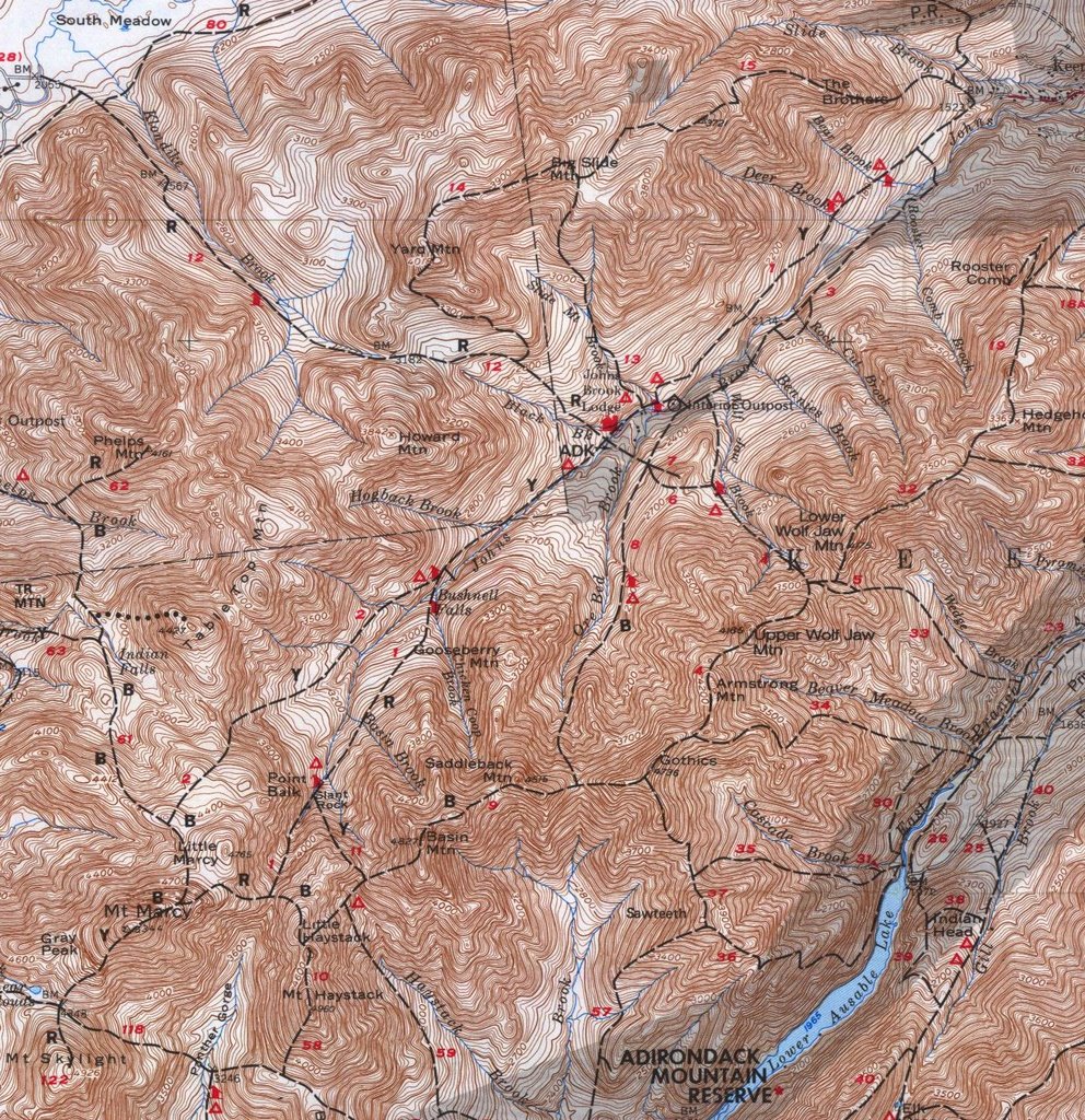
A map of the Great Range region.


The same map with our path marked. It isn't pretty (I imagine Paint isn't the best tool for this), but it shows the trail we followed fairly well.

The Great Range (Part 5) - Ore Bed Brook Trail

The difficult descent down the steep, wet rock of Gothics was over. From here we would be heading down the Ore Bed Brook trail back to our lean-to. We had expected this part of the trip to be fairly easy. We were wrong.

The trail isn't located next to the brook or somewhere conveniently nearby -- the trail is the brook. And as if walking several miles down a brook isn't challenging enough, it was a rapid descent and still covered by snow and ice. In most parts, the water is at least quite shallow, just coating the surface of the rocks as it flows downstream. However, when walking over the snow and ice covering, there is really no way to know what's below you. It wasn't at all uncommon for the snow or ice to collapse out from under us, sending our feet ankle deep in water. Needless to say, our boots were water-logged.


Seth and Ed (left to right) coming down the Ore Bed Brook trail -- water, snow, and ice. (5/6/06, 4:54 p.m.)


In several places along the trail steps have been built to help in the descent down some particularly steep and slippery locations. These helped, but there were plenty of other segments of the trail just as steep and slippery without any ladders. In the lead, navigating one of these segments, Adam took a slide down a particularly icy slope. I watched from behind him as he slid downwards with no way to stop. Luckily, before the slide ended with a splash into a few inches of water, he was able to swing his body around and catch his pack on a lone tree strump. This might have been a startling event earlier in the day, but by now it was nothing new. It just let the rest of us know to choose a different route down that portion of trail.

Eventually, the trail began to break away from the brook itself and move to more solid ground. At this point, we had lost enough elevation that the snow and ice had nearly disappeared. We were on course to make it back to camp shortly after 6:00 p.m.

We had been planning to camp at the lean-to again that night and head back out to the car in the morning. However, after this trip, Seth had proposed the idea of packing up camp and heading back out immediately upon arrival to the lean-to. Ed and I concurred, agreeing that this trip should be over as possible. Adam was the lone dissenter, still suggesting that we camp the night. The vote was 3-1 in favor, so the decision was to head straight out. Once again, we made the wrong call.

Tuesday, May 09, 2006

The Great Range (Part 4) - Gothics

Now it was time to head for the last peek of the trip: Gothics. The trail from Armstrong to Gothics was still covered in snow and ice. Our progress was slowed as our feet continually broke through the snow sending us knee to waist deep. The final ascent of Gothics from this side was a fairly gradual snow covered trail which could have doubled as a ski slope.


The ascent up Gothics. It was certainly still winter up here. (5/6/06, 3:45 p.m.)


Without too much difficulty (besides frequent sinking in the snow), we made it to the summit.


In lieu of a decent view from the summit (due to the weather again), here is the marker placed on the summit by the U.S. Geological Survey. (5/6/06, 3:52 p.m.)


Now came the major difficulty -- descending Gothics. The trail down was mostly steep, bare rock. For several portions, the NYS Department of Environmental Conservation (NYSDEC) has attached cables to the rock to aid in the descent. This is a tricky descent even on dry rock in good weather. We were going to have to navigate it wet.

There are no cables for the initial descent from the summit, so we slowly edged our way down the wet rock trying to keep as solid of footing as possible. We stayed as low as possible to the ground in order that we be prepared for the inevitable "butt-slide." This is when you sit (either intentially or not) with your butt on the rock, your feet in front of you, and your hands to your side (or behind) as you slide down a steep or slippery portion of rock.

Indeed, the butt-slides came quickly for everyone but Adam. Ed went down first early on the rock face, but was able to stop his slide after only a few feet. Seth went down next just a few seconds after. He was able to stop his slide and regain his footing after several yards. I was ahead (slightly further in the descent) looking back toward where Seth had just fallen. My feet were firmly planted on the rock with what I thought was solid footing. Before I knew what had happened, my feet had slipped out from under me on the wet rock and I was in my own butt-slide, heading uncontrollable down the sheer, wet mountain face. I pressed my boots and my bare hands against the rock to attempt to slow my slide to no avail. Looking up, I could see a narrow crevass, about two feet wide, in the rock ahead of me -- I was heading directly toward it. I prepared to brace my legs on the far side of the crevass as I approached to halt my slide. I hoped for two things: that the crevass wasn't too deep and that I would be able to stop before going in.

My legs hit the far wall of the crevass once, rebounding off as my slide continued. I quickly pushed my legs forward again, this time my boots took grip on the rock and I came to a halt -- my legs extending over what turned out to be about a six-foot deep crack in the rock. I sat motionless for a moment to regain my composure after this startling, to say the least, turn of events. It wasn't until a few seconds later that I felt the burning in my hands. This whole time they had been sliding across bare rock. Looking down at them they were red and raw to the touch. Several small cuts ran along the length of my palm. Too bad I wasn't wearing my gloves -- they were left at base camp too.

I took a good minute or two in this spot before even attempting to move again. When I did begin again, I slowly creeped my way down the length of this crack in the rock by bracing my feet on the far wall. It was only another 30-feet or so down to the first level portion in the rock. This would give us a place to stop before we began the descent down the cables.

The initial rock face we were descending (taken from a small leveling below). This is where 3 out of 4 of us went down. Unfortunately, the crack I stopped myself on doesn't appear in this picture. This was steep, wet, and overall a big mess. (5/6/06, 4:15 p.m.)


Next, we had the cables. These ran over similar rock faces to that shown above and proved to be a tremendous help in the climb down. By holding onto these cables as we descended, we were able to avoid a repeat of the events described above. Needless to say, it still wasn't exactly a walk in the park.


The initial cabled descent. From highest-elevation to lowest-elevation: Myself, Ed, Adam. (5/6/06, 4:16 p.m.)


Another shot of the cable descent. (5/6/06, 4:17 p.m.)


Looking up as Seth makes his descent down the cables. (5/6/06, 4:19 p.m.)


We slowly made our way down several sets of cables and off the sheer rock face. After this rapid elevation change, we expected the rest of the hike back to camp to be a fairly easy couple of miles down the Ore Bed Brook Trail. Once again, we couldn't have been more wrong.

The Great Range (Part 3) - Armstrong

The climb from Upper Wolfjaw to Armstrong proved to be difficult. This portion of the trail had some steep rocky sections to navigate, including one 30+ foot rock face with a ladder placed to help in the climb. This trail, difficult when dry, was now covered in ice and snow -- and of course we didn't have crampons. We struggled our way slowly up, mostly by hanging onto overhanging branches and nearby trees to pull ourselves up the ice. There were only a few places where this wasn't feasible. Here, we had to make a few jumps and hope for the best. This was one place where our lighter packs certainly helped out.

At this point, we were absolutely certain we weren't going to be climbing all the peaks we had planned. The snow and ice made the climb dangerous without crampons. We all agreed there was no reason for us to be up there any longer than necessary. We could do the other mountains another time. However, giving up and heading back to camp wasn't exactly an easy task. We were about halfway through the loop now -- past the point of no return. It would be shorter to continue up over Gothics and back.


One section of snowy trail between Upper Wolfjaw and Armstrong. We didn't get any pictures of the difficult portions of the climb. We were too busy trying not to slide down sheets of ice. (5/6/06, 1:51 p.m.)


Us on the summit of Armstrong. This captures the moment quite well. (5/6/06, 2:27 p.m.)


A temporary break in the clouds gave us a mostly clear view of Gothics from the summit of Armstrong. Gothics is one of the more impressive looking peaks with its bare-rock faces. (5/6/06, 3:10 p.m.)


Another shot of Gothics from our momentary break in the clouds. (5/6/06, 3:10 p.m.)

Monday, May 08, 2006

The Great Range (Part 2) - Lower/Upper Wolfjaw

After our more difficult than expected hike to the Ore Bed lean-to, the plan for Saturday (5/6) was to hike the Great Range. This is a row of seven 4000+ foot mountains. Our goal was to do the lower range (Lower Wolfjaw, Upper Wolfjaw, Armstrong, Gothics) followed by Sawteeth which stands next to Gothics. We had hoped to hit part of the upper range if time allowed with Saddleback and Haystack. Needless to say, this was an ambitious goal that we didn't quite achieve.

After Seth and Ed's 1.5 hours of sleep, we packed up for the day. We were leaving a base camp set up at the lean-to so we wouldn't need to carry fully loaded packs. The weather was clear and the forecast for the weekend was good -- only a few possible scattered showers. We set off for Lower Wolfjaw first on this nice sunny morning. Lower Wolfjaw was not too difficult a climb and the summit gave us a clear view of the surrounding range.


View from the summit of Lower Wolfjaw, looking out over the rest of the Great Range - Upper Wolfjaw, Armstrong, Gothics (left to right). (5/6/06, 11:18 a.m.)


Adam, Ed, and Myself (left to right) looking down into the valley from the summit of Lower Wolfjaw. John's Brook Lodge and our camp site at the Ore Bed lean-to lie in that valley. (5/6/06, 11:22 a.m.)


Upper Wolfjaw was the next on the list. As we made our way there, dark clouds began to move in. Perhaps the weather wasn't going to be quite as nice as expected. Part way up the climb, at what proved to be a false summit, it began to rain. "Scattered showers, no problem, this can't last long," we all agreed.


We hunched under a conveniently overhanging rock to take shelter from the rain as we waited for it to pass (Ed, Seth, Myself, left to right). (5/6/06, 12:52 p.m.)


Unfortunately, the rain didn't pass. In fact, it lasted all day. After about ten minutes of waiting, as the cold set in, we decided we'd best keep moving. And here was another one of our great mistakes -- in lightening our loads for the day, we had left our rain gear back at camp. Great idea that was...

As we progressed up the summit of Upper Wolfjaw, the weather only got worse -- the rain mixed with snow at these elevations. Parts of the trail were still snow and ice covered from the winter. This made the ascent difficult without crampons (the metal spikes that attach to the bottom of your boots to give traction on ice). Of course, in another one of our regrettable decisions, we had decided we wouldn't need crampons this time of the year. Luckily, the icy sections didn't prove too difficult to navigate (at least not yet), and we made it to the summit. Unfortunately yet again, the cloud cover and rain blocked what would have been a magnificent view.


Ed, Myself, and Adam (left to right), on the summit of Upper Wolfjaw -- cold and wet. (5/6/06, 1:23 p.m.)


Our spectacular view from the summit... There are some mountains back there -- I promise. (5/6/06, 1:23 p.m.)

The Great Range (Part 1) - Ore Bed Lean-to

I just finished my latest Adirondack hike this past weekend. Unfortunately, the hike was poorly planned from the beginning and it only got worse as time went on. I'll just start from the beginning.

On Friday (5/5), my brother Adam and I left for Keene Valley around 2:00 p.m. We arrived a bit after 4:00 p.m. and stopped at The Mountaineer (a hiking shop in Keene Valley). Adam needed to get a bigger pack and we had to rent some bear canisters to store our food in for the weekend. For those who do don't know, a bear canister is a strong plastic cylinder with a locking lid. These are supposed to keep bears from eating your food, and they are now required for use by overnight hikers in the high peaks region. After 30 minutes or so, we had the new pack and two canisters and we headed up to the Garden Parking Area where we planned to start our hike.

We were going to hike in past the John's Brook Lodge to the Ore Bed Lean-to where we planned to camp. The hike was going fairly well until we reached John's Brook. The bridge we had planned to cross was closed, so we had to take another trail further upstream. Here, we met obstacle number one: the melting Spring snows meant that the water of John's Brook was extremely high and fast moving. Of course, there was no bridge at this point. After about 45 minutes of trying to find a safe crossing, and several failed attempts (and one soaked boot from going in knee deep), we decided we had to make our own way. We managed to cross halfway on a fallen tree trunk to some solid rocks at midstream. From here, we lifted and dragged the fallen tree up to throw as far as possible toward the far bank. This was going to be our crossing -- of couse, if this failed, there was no turning back. The momentum of the tree-toss almost threw us face first into the stream, but it landed true right where we needed it. With an extra-long leap of faith we could make it to the far bank. Despite our fully loaded packs, we made the leap -- we had overcome obstacle number one.

Shortly thereafter, we crossed the Ore Bed Brook without too much trouble (it only took us five minutes or so to find a crossing this time) and continued on toward the lean-to. It was dark for the last half hour or so of the hike, but we arrived without any further difficulties around 9:00 p.m. after a three hour hike. Here, we set up camp and waited for our two friends to arrive.

Seth, and his coworker Ed, were flying up from South Carolina into Albany shortly before 10:00 p.m. They were renting a car and driving up to Keene Valley that night. They planned to hike in to meet us at the Ore Bed lean-to. Their hike started at 1:00 a.m. and ended with their arrival at our camp at 5:00 a.m. An all-night hike followed by the all-day hike we had planned for Saturday -- certainly a bad idea if you asked me. But, it was their idea after all.

They got about an hour and a half of sleep before we got ready to set off on the real hike. This I will discuss more later. For now, here's some pictures of this first leg of the journey and our camp.

Adam standing outside our lean-to. Yes, it was dark. (5/5/06, 10:09 p.m.)

The Ore Bed brook, closeby to our lean-to. (5/6/06, 7:16 a.m.)